August 4th, 2010 by Ricardo Píriz
magicGNSS version 2.5 is now available incorporating the IBPL algorithm supporting GPS+GLONASS. IBPL stands for Isotropy-Based Protection Level, a proprietary algorithm developed by GMV for autonomous pseudorange-based user receiver integrity.
The new IBPL module within magicGNSS is a demonstrator of the IBPL concept, but of course not an operational software, since IBPL is intended to run inside the user receiver.
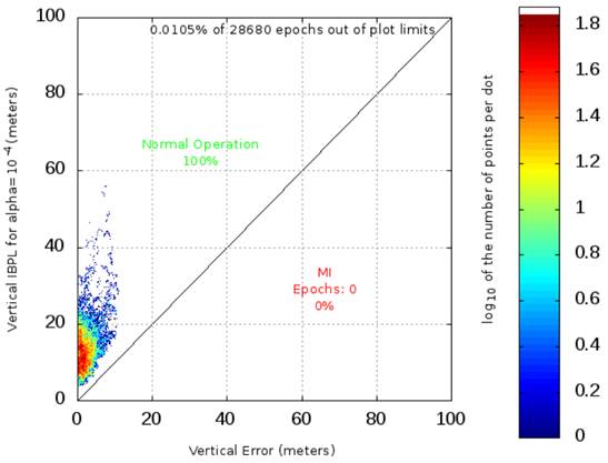
Example of Stanford diagram from IBPL
Read the rest of this entry »
Posted in Announcements | Comments Off on Autonomous integrity
May 13th, 2010 by Ricardo Píriz
The Precise Point Positioning (PPP) module in magicGNSS is now capable of processing GPS and GLONASS data just acquired, in RINEX format.
Real-time GPS and GLONASS orbits and clocks needed by PPP are generated internally. Orbit and clock products are generated twice per hour (at 00 and 30 minutes) with a latency of 30 minutes. The internal time scale for satellite clocks is driven by an on-ground H-maser.
When rapid and final GPS orbits and clocks from IGS become available, PPP uses them instead of our internal products. For GLONASS, our internal products are still used but satellite clocks are post-processed to be aligned to IGS Time. Therefore it is always possible to combine GPS and GLONASS in PPP.
GLONASS products are only available starting 2010/01/01.
Posted in Announcements | Comments Off on PPP now supporting GPS and GLONASS real-time data
March 8th, 2010 by Ricardo Píriz
magicGNSS now supports the ETRS89 coordinate reference system in Precise Point Positioning (PPP). ETRS89 has been recently declared the official reference frame in continental Spain. ETRS89 stands for European Terrestrial Reference System 1989. In this system the coordinates are “frozen” at the 1989.0 epoch (1st of January 1989), in order to maintain a network of stable reference landmarks throughout the country, considering that the Eurasian tectonic plate drift is around 2 cm per year on Spain.
PPP uses as input satellite orbits given in the global ITRF05 system (actually IGS05, the IGS realization of ITRF05). Therefore the resulting user receiver coordinates are given in ITRF05 too, and they are estimated at the date of the user measurements. For users in Spain we are now converting these ITRF05 coordinates to ETRS89 and reporting them in the PPP outputs.
How do we do the conversion from ITRF05 to ETRS89? We take as reference a set of 23 fiducial GNSS stations located all over Spain and maintained by the IGN, the Spanish national mapping agency. Only stations on the Iberian Peninsula are chosen. For these stations, every month we process offline one day of data in PPP, and then we do a Helmert transformation between the official ETRS89 coordinates published by the IGN and our PPP solution in ITRF05. Then, at PPP user level, we apply the Helmet transformation parameters in the opposite direction in order to obtain the ETRS89 user coordinates.
The residual fit after the Helmert transformation between ITRF05 and ETRS89 for the 23 IGN stations is around 6 mm only (3-D RMS). This means that the loss of accuracy at user level due to the conversion to ETRS89 is well below the cm, which is at the same level as the PPP accuracy itself.
Posted in Announcements | Comments Off on PPP now supporting ETRS89 in Spain
March 1st, 2010 by Ricardo Píriz
On February 27, 2010, at 06:34 UTC, Chile was hit by an earthquake rating a magnitude of 8.8. The earthquake epicenter was offshore from the Maule Region, approximately 115 km (71 mi) north-northeast of Chile’s second largest city, Concepción.
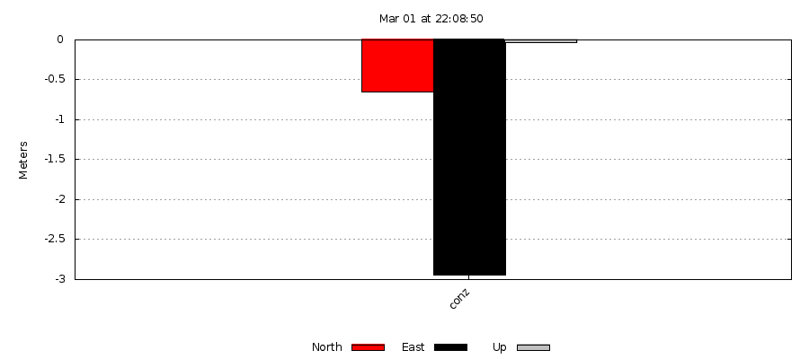
The University of Concepción hosts the GNSS station called conz, tracking GPS and GLONASS satellites. conz survived the earthquake during several hours and continued recording data until 20:00 UTC.
The following plot shows the conz station displacement as a consequence of the earthquake. The plot shows the comparison of coordinates between two GPS+GLONASS Precise Point Positioning solutions, the first one using 5 hours of data before the earthquake, and the second one using 6 hours of data after the earthquake.
See also the IGS mail about predicted site displacement.
Posted in Events | Comments Off on The Chile earthquake observed by GPS and GLONASS
February 17th, 2010 by Ricardo Píriz
GPS satellite signals experiment a delay when they go through the atmosphere. One of the applications of GPS data processing is the extraction of atmospheric water vapour content from the tropospheric delay in the GPS measurements. Information about water vapour content in the air is useful as input for weather forecast models.
In order to demonstrate the capabilities of magicGNSS for weather prediction applications, we have set up a testbed to process 5 GPS stations in Madrid, Spain. The stations are called: gap1, igne, mad2, madr, and vill. The maximum distance between any pair of stations is around 50 km. The mad2 and madr stations share the same location, therefore their zenith tropospheric delays should be identical.
The near-real time station data is processed by the Precise Point Positioning (PPP) algorithm. The station data is processed automatically every hour using the new Scheduler in magicGNSS. The results are shown on the following live plots, updated 35 minutes after the hour. Time is UTC.
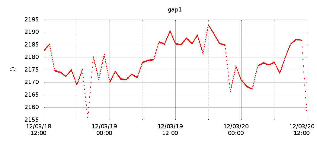
gap1 Zenith Tropo Delay
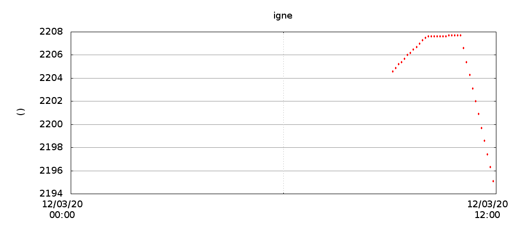
igne Zenith Tropo Delay
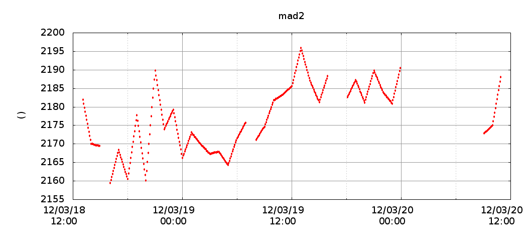
mad2 Zenith Tropo Delay
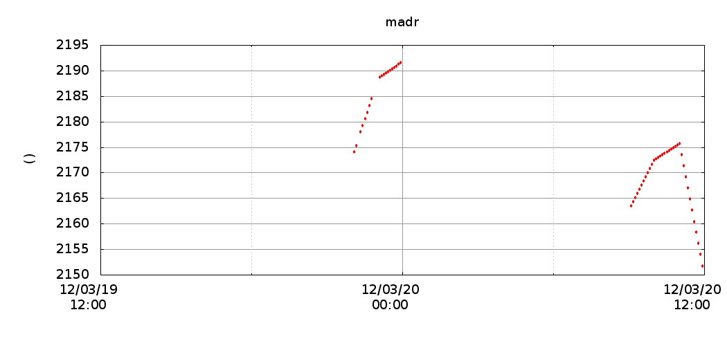
madr Zenith Tropo Delay
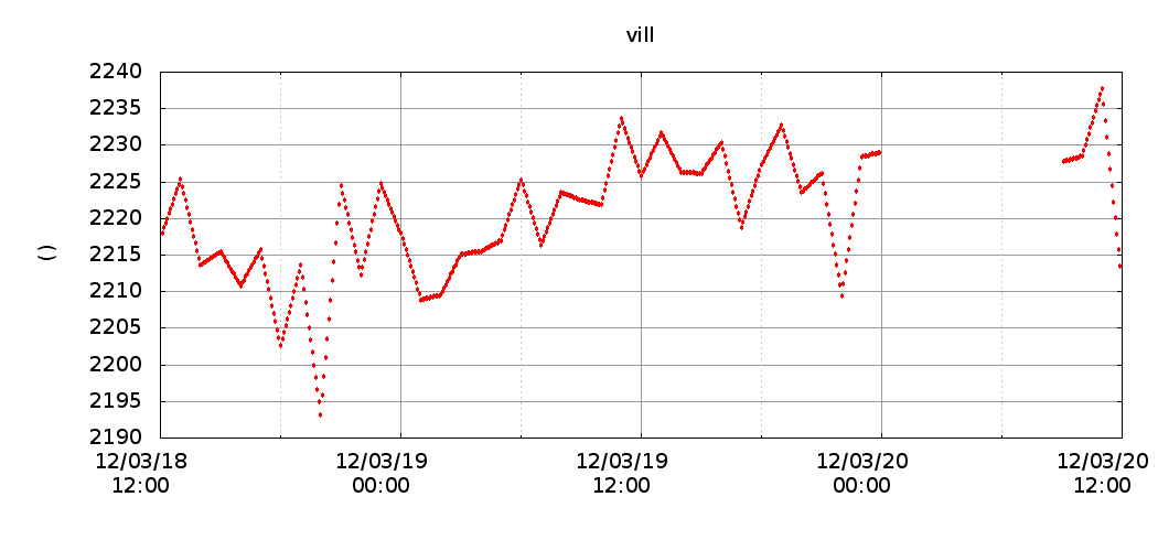
vill Zenith Tropo Delay
Posted in Announcements | Comments Off on Zenith tropospheric delay in Madrid


