Archive for the ‘Tips & Tricks’ Category

PPP and the atmosphere

April 1st, 2009 by Ricardo Píriz

The tropospheric delay in the GPS signals is considered a nuisance by most PPP users. Something you must get rid of in order to observe more interesting things like the station coordinates or clock. However the tropospheric delay in itself might have interesting applications, for example in weather prediction, since part of the tropo delay is caused by the water content of the atmosphere.

cadiz

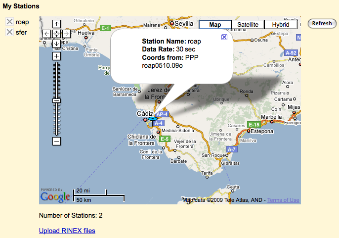
Let us see how the PPP in magicGNSS calculates (and removes) the tropo delay. It is basically modeled as a delay on the station vertical (zenith), using a mapping function to account for the different satellite-to-station signal elevations. The zenith delay is then estimated as a constant value every hour, for each station. (more…)
PPP and tectonic plate motion

March 31st, 2009 by Ricardo Píriz

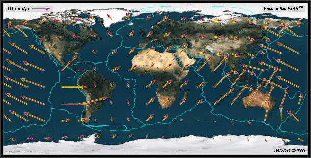
We have recently introduced our new algorithm for Precise Point Positioning (PPP). One of the things you can do with PPP is to monitor the displacement of your station(s) over long periods of time. Even if your station is installed on a very stable location, it will unavoidably move a little bit over the years due to the slow but steady displacement of the tectonic plate the station is placed on. The plate motion velocity changes a lot from plate to plate, the following map (from UNAVCO) shows a general view of the Earth:

nuvel1a_nnr2

(more…)

Update My Station Coordinates

March 23rd, 2009 by Ricardo Píriz

When you upload station data in magicGNSS (see How to upload station data), the station coordinates are read from the RINEX file header and stored in the magicGNSS database. The first time you upload data from a station you will see ‘Coords from: RINEX’  when you click on the station name or icon on My Stations. Coordinates from the database are used as a priori (initial) values by the ODTS and PPP algorithms.

If you want to refine your station coordinates in the database, just upload enough data from that station (one day is recommended), process it in PPP and click on ‘Update My Station Coordinates’ on the PPP Settings: (more…)

Batch upload

February 25th, 2009 by Ricardo Píriz

We have explained how to upload and process your own station data in magicGNSS (in a previous entry). If you need to download many daily RINEX files from the IGS server and upload them in your magicGNSS account by ftp (for *pro* users only), here are a couple of very simple UNIX scripts that might help you. They are based on the ncftpget and ncftpput tools. The download script is called in this way:

./download yy ddd stations.txt (example: ./download 09 040 mystations.txt)

where stations.txt is a simple file whose rows contain the station names (here is an example of stations.txt file). The daily RINEX files are downloaded onto the current local directory.

The upload script is called like this:

./upload yy ddd stations.txt magicuser.cfg (example: ./upload 09 040 mystations.txt johnsmith.cfg)

where magicuser.cfg is a file that contains your magicGNSS account information (here is an example of magicuser.cfg file). The daily RINEX files are uploaded and then deleted from the current local directory.

Comparing clocks and coordinates with COMP

February 13th, 2009 by Ricardo Píriz

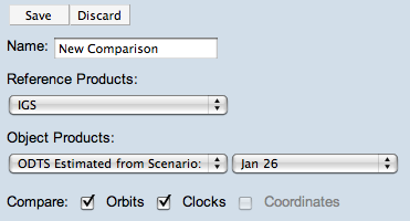
Last December we introduced the new module COMP to compare satellite orbits. As from today you can also compare satellite clocks and station coordinates using COMP.

comp_clocks

As in the case of orbits, clocks from ODTS (estimated and predicted) can be compared to IGS products (only rapid and final clocks, but not ultra-rapid ones yet, sorry). IGS rapid and final clocks are automatically downloaded and stored on the magicGNSS server. Rapid IGS clocks have a latency of around 2 days and final clocks have a latency of nearly two weeks. When comparing with IGS clocks, COMP tries always to choose the final IGS clock, and if it is not available it chooses the rapid one instead. (more…)