October 3rd, 2008 by Álvaro Mozo
One of the available scenario settings is the “Refine Station Coordinates” check box. When this is checked, magicGNSS will estimate the station coordinates, yet keeping a constraint to their initial value, as provided by ITRF (or the IGS). This refinement can compensate for some inaccuracies, such as some mismodelling of the Earth motion, thus helping to achieve better performances.
On the other hand, when the observability is not good enough (e.g. when the number of stations/data is insufficient or their distribution is poor) the estimation of the coordinates may be correlated with other parameters and lead to a degradation of performances! So, should one check the box or not?
Read the rest of this entry »
Tags: ODTS, Tips & Tricks
Posted in Tips & Tricks | Comments Off on Refine station coordinates: when?
October 2nd, 2008 by Ricardo Píriz
As the magicGNSS blog gets more entries it obviously becomes increasingly difficult to find some specific information on it. But do not worry, that is why the Search window is there at the top right. Just type what you are looking for (e.g., “presentation” or “paper”) and click on Search. Enjoy!
Tags: Tips & Tricks
Posted in Tips & Tricks | Comments Off on Looking for something on the blog?
September 30th, 2008 by Ricardo Píriz
magicGNSS now supports quite a few web browsers: IE, Firefox, Safari, and Chrome (the new browser from Google). At magicGNSS we like to be browser-neutral, but log into your magicgnss.gmv.com account using Chrome and you will notice that the application responds remarkably faster. I belive the reason for this is V8, Google’s open source Javascript engine, which seems to perform really well!
Tags: Technology
Posted in Announcements | Comments Off on Multi-browser support
September 29th, 2008 by Ricardo Píriz
What is the most exciting way to use magicGNSS? Actually, the easiest one! Inside your magicGNSS account, just click on New to define a new scenario (scenario Name and Start and End dates are provided by default), then click on Save to create the new scenario, and then click on Run to process the data and generate results.
In fact the application selects by default yesterday as Start Date and today as End Date. In this way you get the most recent ODTS estimations possible, for example to monitor the latest behaviour of all GPS satellite clocks, with a latency of just a couple of hours.
Start and End dates are relative to GPS Time, not to the local time of your town! Currently GPS Time is ahead of UTC by just 14 seconds, therefore UTC (or its equivalent Greenwich Mean Time) is a good approximation to GPS Time.
Tags: ODTS, Tips & Tricks
Posted in Tips & Tricks | Comments Off on New, Save, Run… and get real-time clocks in 3 clicks!
September 28th, 2008 by Ricardo Píriz
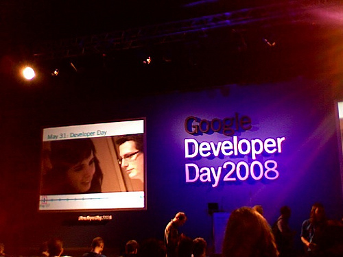
 Last week I attended the Google Developer Day in Madrid. It was a very interesting event where Google engineers and gurus from all over the world gave presentations and workshops, a unique opportunity to have an overview of the state of the art in internet technologies today. Among other things, Android, the new open source operating system for mobile phones was introduced and explained. Chrome, the new web browser from Google, was also presented.
One of the most inspiring speeches was the one given by Dion Almaer on The Future of Web Applications (watch video, or see presentation). Dion Almaer is one of the fathers of AJAX, the web technology that allows asynchronous communication between the browser and the server to update different parts of a web page without reloading the whole page. This creates more responsive and interactive web applications. For example, in magicGNSS you can run a scenario, monitor the progress banner, and at the same time create new scenarios or delete existing ones. AJAX is behind all this.
Dion’s talk gave me the idea to write about the past of the web and Graphical User Interfaces (GUIs) and about how much things have changed today. Back in 1993 I got my first job with GMV based at ESOC, the European Space Operations Centre in Darmstadt, Germany… But this entry is getting a bit too long, so I will post the rest of the story in this blog some other time.
To be continued…
Tags: Events, Technology
Posted in Events | Comments Off on At the Google Developer Day in Madrid


