Ocean loading
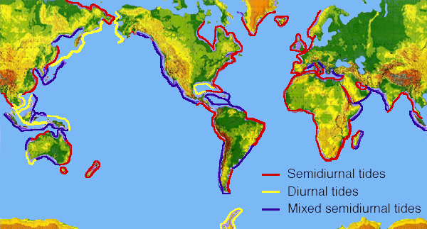
January 18th, 2010 by Álvaro MozoOcean loading is the deformation of the Earth due to the weight of the ocean masses. The water in the ocean moves due to the gravitational pull of the Moon and the Sun (this is the tides), and causes the Earth, which is not completely rigid, to deform according to the varying load of the ocean’s water. The deformation is periodic, following the relative motion of Earth, Moon and Sun, however such relative motion is rather complex and thus periodicity has to be represented with several harmonic terms of different period.
Most commonly, the 11 first terms (i.e. those with higher amplitude) are retained to model this effect.
Ocean loading can be perceived as a periodic displacement of the station position (especially in coastal areas), as well as a periodic variation of the Earth’s gravity.
How is ocean loading taken into account in magicGNSS?
magicGNSS considers ocean’s tide impact in Earth’s gravity field, and implements an ocean loading model to take into account station displacement. For this, specific model parameters have to be generated for each station. These values are provided by Onsala Space Observatory, in Sweden: one has to submit station coordinates to Onsala’s service to get the model parameters in return. Such parameters are available for the Core Stations only.
As of magicGNSS version 2.2, we have implemented a procedure to obtain simplified parameters for the User Stations and the stations submitted to the e-mail PPP service, thanks to the kind support from H.G. Scherneck from Onsala Space Observatory. With these parameters, most of the station displacement is taken into account, as can be seen either when processing short arcs (a few hours), where the daily periodic displacement is not averaged out, or in the estimation of very stable clocks.
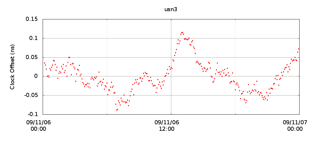
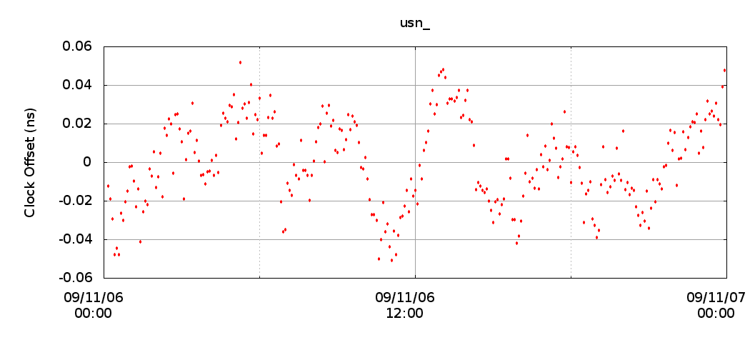
Ocean loading has to be taken into account for the estimation of very stable clocks (e.g. H-Masers), otherwise part of the tidal displacement correlates with the receiver clock estimates, and can be seen as a periodic oscillation in the station clock (and as a “bump” in the Allan Deviation plot). As an example, we have run two PPPs for IGS’ USN3 station, which has a very stable H-Maser clock and is not far from the coast. The first plot below (labeled usn3) shows the detrended clock with no ocean loading considered. The second plot (labeled usn_) shows the detrended clock considering the ocean loading model for user stations. Note the difference in the y-scale!
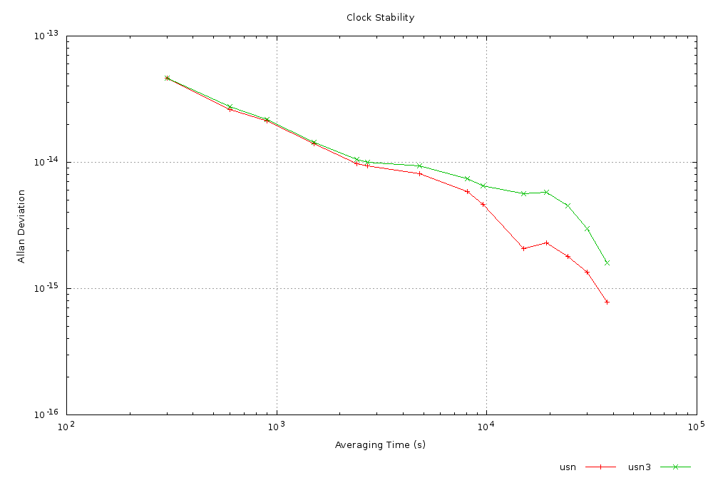
This can also be clearly seen in the Allan Deviation plot. The clock obtained using the ocean loading model is more stable:
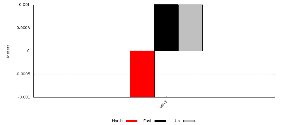
Note also that, as outlined before, when processing one day of data most of the periodic variations are averaged out and the actual estimation of coordinates can be very good. In the example above, the coordinates estimated with and without the ocean loading model differ in 1mm!
Tags: Algorithms, ODTS
