PPP and the atmosphere
April 1st, 2009 by Ricardo PírizThe tropospheric delay in the GPS signals is considered a nuisance by most PPP users. Something you must get rid of in order to observe more interesting things like the station coordinates or clock. However the tropospheric delay in itself might have interesting applications, for example in weather prediction, since part of the tropo delay is caused by the water content of the atmosphere.
Let us see how the PPP in magicGNSS calculates (and removes) the tropo delay. It is basically modeled as a delay on the station vertical (zenith), using a mapping function to account for the different satellite-to-station signal elevations. The zenith delay is then estimated as a constant value every hour, for each station.
But how reliable is the tropo delay calculated by PPP? One experiment we can do is to process data from two stations that lie close together (let us say a few hundred meters apart). Since the atmospheric conditions are virtually the same for both stations, the tropo delay should be nearly identical for both.
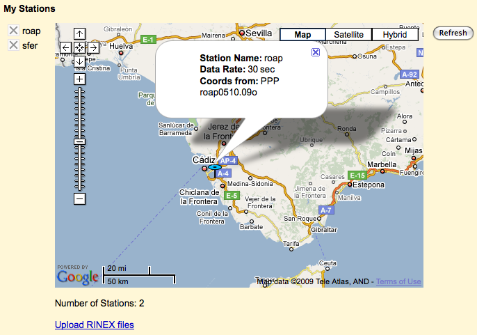
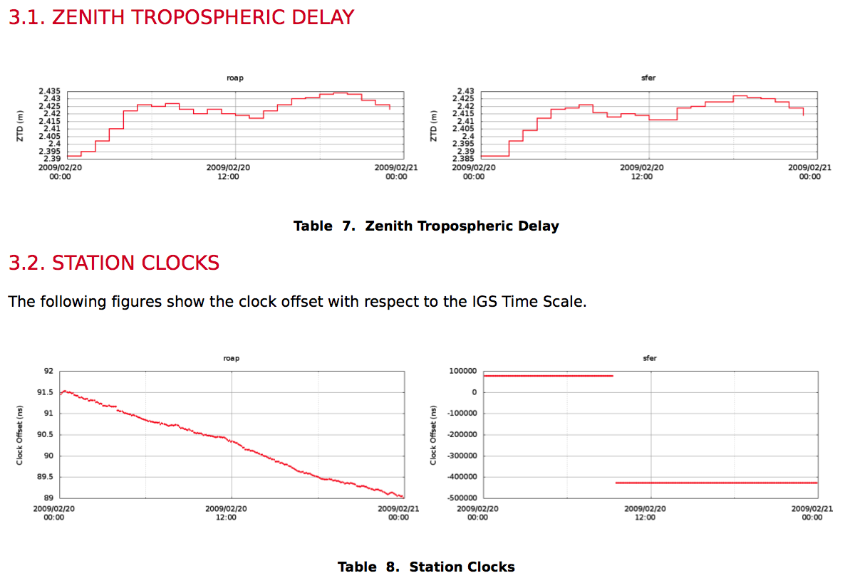
For this experiment we chose two stations situated in the beautiful town of San Fernando in Cádiz, Southern Spain, where the Spanish Navy Observatory is located. The two stations are called ‘roap’ and ‘sfer’. We processed one day of RINEX data from the IGS server (day 09 051) with PPP, and this is what we obtained:
As can be seen from the picture, the tropo delay evolution is very similar for both stations (within half a cm roughly), even if the behavior of the two station clocks is very different. One of the stations has moreover a huge jump on the clock, which does not affect the tropo calculation. The full PPP report can be downloaded here.


