Archive for the ‘Help’ Category

About satellite clock interpolation

October 5th, 2009 by Ricardo Píriz

Starting on GPS Week 1406 (Dec 17, 2006), the International GNSS Service (IGS) publishes final GPS satellite clocks at a rate of 30 seconds, in addition to the usual 5-minute rate. These high-rate satellite clocks are very useful for Precise Point Positioning (PPP), the algorithm in magicGNSS that processes stand-alone station data to calculate the station position, clock, and tropo delay.

Using 30-sec satellite clocks as input for PPP, one can choose a 30-sec station data rate without having to interpolate the input satellite clock values. magicGNSS supports 30-sec and 5-min data rates in PPP. As from today, if you select a 30-sec data rate in PPP and final 30-sec satellite clocks are available from IGS, they will be used instead of 5-min clocks. Remember that IGS final products have a latency of 2 to 3 weeks.

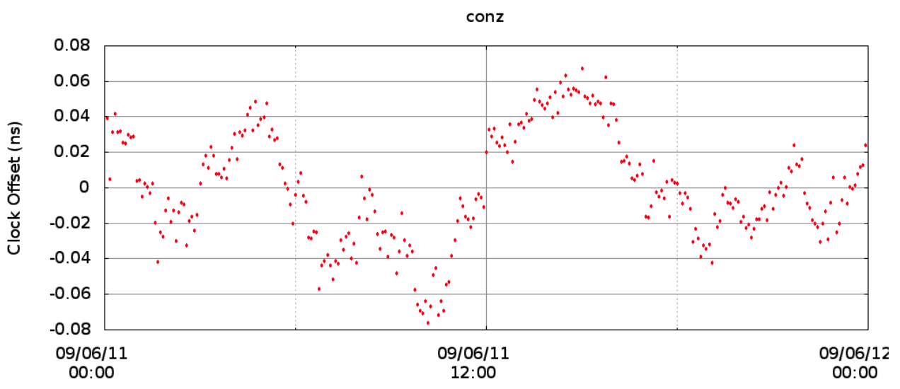
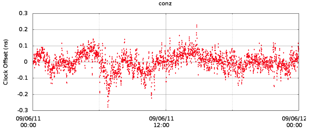
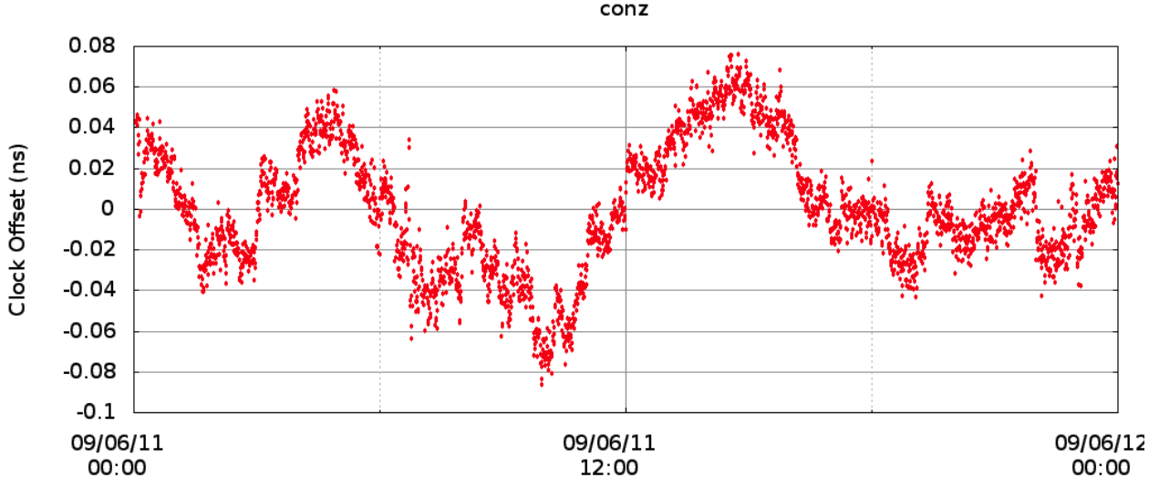
Until now if you selected a 30-sec data rate in PPP, the input 5-min clocks from IGS had to be interpolated. Clock interpolation is a bad thing because the interpolated values do not reflect the true satellite clock behavior at the interpolation epochs. The following figures show the effect of clock interpolation on the CONZ clock estimation from PPP:
conz_clock_5min

5-min station clock from PPP (no interpolation)
conz_clock_30secInt

30-sec station clock from PPP (interpolation, WRONG!)
conz_clock_30sec

30-sec station clock from PPP (no interpolation)
Video tutorials

August 20th, 2009 by Ricardo Píriz

Check out the magicGNSS video tutorials on YouTube!

Introduction to magicGNSS:

How to upload station data in magicGNSS:

Introduction to PPP:

Introduction to ODTS:

Introduction to IBPL:

GPS antennas and positioning

July 24th, 2009 by Ricardo Píriz

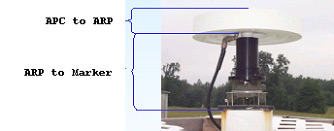
In GPS antennas, there are three important reference points that have to be considered, as shown in the following picture (borrowed from NRCan):

arp

The Antenna Phase Center (APC) is the virtual electronic point that actually tracks the GPS signals. In principle, coordinates from any GPS receiver or station refer to this point.

However, for geodetic applications, since the antenna might be replaced by another model at some time, it is important to consider a physical point attached to the ground. This is called the Marker. (more…)

(Deprecated) About station icons

May 28th, 2009 by Ricardo Píriz

This information is deprecated, please visit the new post.

Just a quick explanation about the meaning of station icons in magicGNSS:

GPS+GLONASS core station

GPS core station

deselectedDeselected station

reference_clockReference clock (in ODTS)

GPS+GLONASS user station with precise coordinates

GPS+GLONASS user station (or rover) with approximate coordinates

GPS user station with precise coordinates

GPS user station (or rover) with approximate coordinates

GPS+GLONASS public station with precise coordinates

GPS+GLONASS public station with approximate coordinates

GPS public station with precise coordinates

GPS public station with approximate coordinates

PPP and the atmosphere

April 1st, 2009 by Ricardo Píriz

The tropospheric delay in the GPS signals is considered a nuisance by most PPP users. Something you must get rid of in order to observe more interesting things like the station coordinates or clock. However the tropospheric delay in itself might have interesting applications, for example in weather prediction, since part of the tropo delay is caused by the water content of the atmosphere.

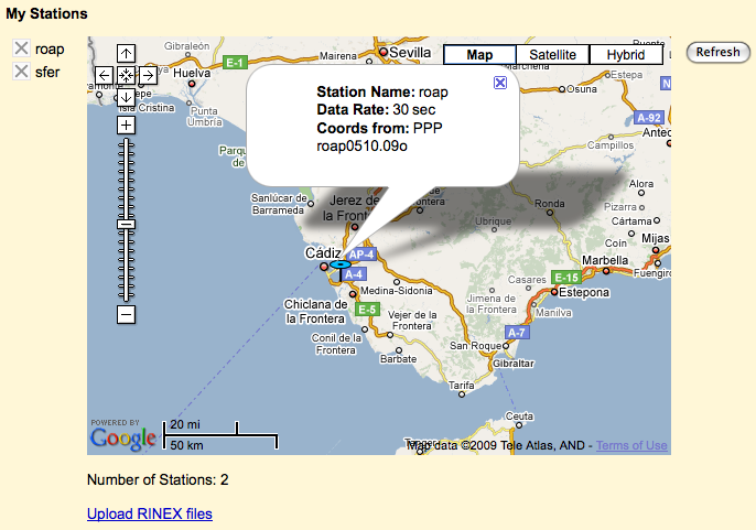
cadiz

Let us see how the PPP in magicGNSS calculates (and removes) the tropo delay. It is basically modeled as a delay on the station vertical (zenith), using a mapping function to account for the different satellite-to-station signal elevations. The zenith delay is then estimated as a constant value every hour, for each station. (more…)