The Chile earthquake observed by GPS and GLONASS
March 1st, 2010 by Ricardo PírizOn February 27, 2010, at 06:34 UTC, Chile was hit by an earthquake rating a magnitude of 8.8. The earthquake epicenter was offshore from the Maule Region, approximately 115 km (71 mi) north-northeast of Chile’s second largest city, Concepción.
The University of Concepción hosts the GNSS station called conz, tracking GPS and GLONASS satellites. conz survived the earthquake during several hours and continued recording data until 20:00 UTC.
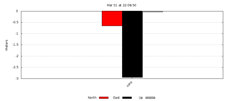
The following plot shows the conz station displacement as a consequence of the earthquake. The plot shows the comparison of coordinates between two GPS+GLONASS Precise Point Positioning solutions, the first one using 5 hours of data before the earthquake, and the second one using 6 hours of data after the earthquake.
See also the IGS mail about predicted site displacement.


