The Japan earthquake observed by GPS and GLONASS
March 15th, 2011 by Álvaro MozoA 9.0-magnitude earthquake hit Japan on Friday March 11th, 2011 at 05:46 UTC. The epicenter was reported to be 130 kilometers (81 mi) off the east coast of the Oshika Peninsula, Tōhoku.
The National Astronomical Observatory in Mizusawa hosts a GNSS station which belongs to the IGS network. This station, labeled mizu, is located at around 140 km (87 mi) northwest of the epicenter, and provided GPS and GLONASS data at 1-sec rate until 06:00 UTC.
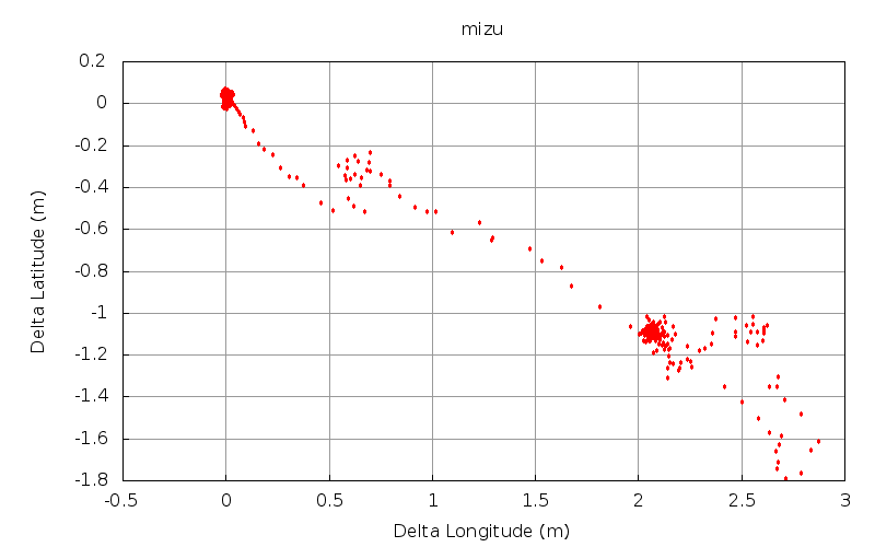
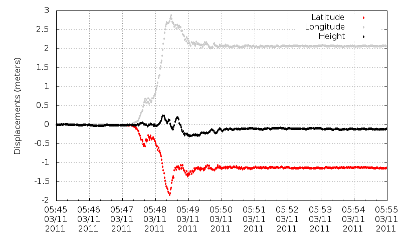
The following plots show the displacements of the mizu antenna coordinates during the earthquake, computed with magicGNSS’ GPS+GLONASS kinematic PPP. In both plots the positions are computed every second.
The IGS data from the mizu station for March 11th, 2011 used to compute the above plots have been made public in magicGNSS, so you can log into your account and process them yourself right now.


